Well Mapping 

Here we present the mapping
portion of our site. Map icons representing
the wells are placed at the bottomhole location
or lateral terminus and not the surface.

  • wellmaping-img Individual Wells' API Information.
  • wellmaping-img OCC and OTC Production for this unit (if known).
  • wellmaping-img Links to recent Application and Orders filed within this section.

Production 

(January 1, 2000 to present, except where noted)

Oklahoma Corporation
Commission Production

Gas Only

Oklahoma Tax
Commission Production

Gas & oil

Oklahoma Corporation  
Commission

Current Thur October, 2022

Oklahoma Tax
Commission

from July, 1990 -Thru October, 2023

Utility Searches

  • wellmaping-imgOperator Addresses
  • wellmaping-img Respondents - (5,101,040 as of 07/2023)
  • wellmaping-img County Lease Activity   Coverage Area
View Coverage Area

Conservation Docket Orders and
Applications Databases

  • wellmaping-img Spacing Orders
  • wellmaping-imgPooling orders
  • wellmaping-imgIncreased Density Orders
  • wellmaping-imgLocation Exception Orders
  • wellmaping-imgUnitization Orders
  • wellmaping-imgNewly filed Applications

Well Information Databases

  • wellmaping-img Well Commingles - August 2007 to present.
  • wellmaping-imgWell completion records � 1997 to present.
  • wellmaping-imgPlugging records � 1997 to present.
  • wellmaping-imgTransfer of ownership � 1997 to present.
  • wellmaping-imgIntent to Drill records -1989 to present.
  • wellmaping-imgInitial 1016 Back Pressure gas tests - 1997 to present.
  • wellmaping-imgElectric Logs - 2000 to present.
  • wellmaping-imgDirectional Surveys - OCC Collection

Pre-1997 Historical Well Database

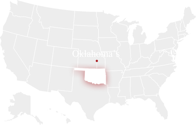
This database contains a listing of the number of well records (completion, plugging & transfer of ownership) for each section in Oklahoma that are scanned and imaged, but are not a part of our online services. These hard copy or digital images can be obtained by calling our office during regular business hours. ALL historical well completion, plugging & transfer of ownership records (including associated images) for the counties listed on this link are searchable on our site.  Additional counties will be added as they are completed.

Click Here For Current Map

Geological Exhibits

Structure maps, isopach maps, production maps and various technical data sheets submitted with spacing, increased density & location exception applications are linked to the applicable cause within the images button. These documents are scanned on a daily basis as they are received, usually within a few days of the issuance of the final order in any given cause.

Click Here For Sample